A major rail line is returning to London’s Tube map 22 years after being removed.
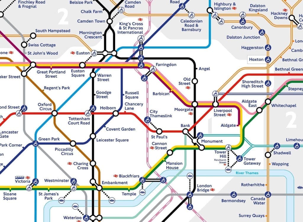
Thameslink services will be back on the map from next month following a long-running campaign, Transport for London (TfL) said.
The network runs between Bedford and Brighton via central London, including stations such as London Bridge, Blackfriars and St Pancras International. It will be marked as a pink and white segmented line where it passes through central London.
Related articles:
- Rail fares in England to rise above inflation for first time since 2013
- Crossrail doubles test trains in ‘important milestone’
- Driverless Tube trains would cost £7 billion, claims leaked document
TfL said its return to the Tube map is a “temporary” measure to help people move around the capital during the coronavirus pandemic, and will be reviewed at the end of 2021.
Thameslink services were first displayed on the map in 1987, but removed in 1999.

There has been growing pressure on TfL to reverse the decision by politicians and public transport groups.
Earlier this year, the London Assembly’s Transport Committee called for the line to be back on the map by August.
Responding to Wednesday’s announcement, Dr Alison Moore, who chairs the committee, said: “The Thameslink line is an essential addition to the Tube map so Londoners who have to travel during the COVID-19 pandemic have more options to do so, not least during this difficult festive period.
“It is vital people can be as safe as possible when they travel and bigger trains will help maintain important social distancing.
“The Transport Committee recommended that Thameslink be added to the Tube map to help Londoners with disabilities because these trains are designed for accessibility first and foremost.
“It is time for TfL to keep Thameslink on the map permanently for better accessibility across the city.”
Thameslink managing director Tom Moran said: “We’re delighted that Thameslink stations across London have been temporarily added to the iconic Tube map, particularly those in areas of south-east and north London that are now appearing for the first time.
“Adding Thameslink services will be especially helpful now, as we know people want to plan their journeys carefully and ensure they can socially distance.
“This will mean every passenger can see all the connections available to them in one place. Thameslink is a great option for passengers in London, with trains every few minutes, a journey time from St Pancras to London Bridge of under 15 minutes and accessible stations.”
TfL’s head of customer information and partnerships Julie Dixon said: “This has been a complicated addition to make to the map, but one that we feel will benefit Londoners as part of our work to promote safe, clean and reliable public transport use across the city.”


